Civil Engineering and Surveying
- Concrete Cost Estimator
- Concrete Continuous Footing
- Landscape Bidding and Estimating
- Construction Cost Estimating
- Concrete and steel cost estimation
- Construction Cost Estimate Breakdown
- Construction Estimating Worksheet
- Home Construction Cost Estimate
- Estimate Pricing Sheet
- Sheet for General Contractor
- Construction Cost Estimate
- Labor Materials Cost Estimator
- Masonry Estimating Sheet
- Sheet for Building Contractor
- Construction Schedule Bar chart
- General Cost Estimator Sheet
- General Construction Estimate
- Building and Road Estimating Sheet
- Detailed expense estimates
- Door and Window Takeoff Sheet
- General Construction Cost Estimating Sheet

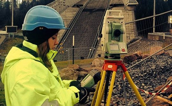
Definition Of Surveying: Surveying means the system of examining and recording the properties of a land area span so that a plan can be designed or a map can be created easily for construction.
The surveying is categorized as follow :-
• Geodetic Surveying: Surveys are conducted on a widespread area by applying the control networks which stretch over long ranges.
• Cadastral Surveying: Surveys are accomplished for determining the ownership and boundaries of the land.
• Topographical Surveying: Surveys are performed to find out the structure of the land structure together with deviation in land heights.
• As Built Surveying: Surveys are conducted as soon as a construction project is finished to test out discrepancy from proposed design.
• Photogrammetry (Aerial Surveying): Surveys are conducted by snapping photographs from elevated ground stations.
• LiDAR (Aerial Surveying): Surveys are done with the help of remote sensors and light reflected by lasers to calculate distances.
Some recognized methods for conducting survey :
• Triangulation: Under this method, several triangles are inter-related and overlapped to calculate angles from a surveying station.
• Trilateration: It abides by the similar method as in Triangulation with supplementary use of Electronic Distance Meter (EDM).
• Traverse: Under this method, several lines of pre-measured lengths are inter-related to work out angles and distances.
• Leveling: Under this method, the discrepancy in heights in a terrain are calculated by applying the graduated rods.
Also Read: How to drop perpendicular on survey line in land surveying
• Radiation: Under this method radiating lines are outlined from a focal point to defined boundaries which are transformed to a small scale surveying sheet.
The surveying is conducted for the following purposes :
1. To develop the topographical map that demonstrates the hills, rivers, forests, valleys, etc.
2. To create the engineering map that demonstrates the engineering details like highways, railways, canals, dams, reservoirs, etc.
3. To make the contour map to find out the best probable route and amount of earthwork necessary.
4. To create the geographical and political map.
5. To build up archeological map that illustrates the places where ancient relics may have found.
6. To develop cadastrial map that demonstrates the boundries of properties like houses, buildings, fields, colonies, etc.
7. To form a military map that demonstrates various strategic points which are vital for the defence of a country.

- Application of concrete calculator
- Roofing Calculator can streamline the roof estimating process
- House construction cost calculator
- Engineering column design excel spreadsheet
- Material Estimating Sheet with Excel
- Materials List and Cost Estimate Worksheet
- Concrete Slab Estimating Calculator Sheet
- Common types of foundations for buildings
- Online calculation of construction materials
- Estimating with Excel for the Small Contractor
- Concrete Beam Design Spreadsheet
- Virtual Construction Management app for construction
- Autodesk’s Project Skyscraper
- Reed Construction’s Reed Insight
- Manage your construction project documentation
- Costimator, the popular cost estimating software
- On Center Software for construction professionals
- Free Construction Estimating Software
- Plumbing Calc Pro
- Cost Estimate Worksheet
- HVAC Piping Quantity Takeoff Worksheet
- Construction Estimating Software Sheet
- Estimate Cost Templates
- Construction Punch List
- Construction cost estimating template consisting estimating basic
- Gantt Chart Template for Excel
- Download Civil Engineering Spreadsheets with Verification
- The Building Advisor Estimating and Budgeting Worksheet
- Spreadsheet for design of concrete bridge
- Construction Estimating Software Free


