







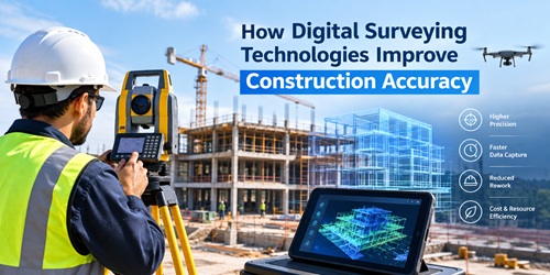
How Digital Surveying Technologies Improve Construction Accuracy
- Concrete Cost Estimator
- Concrete Continuous Footing
- Landscape Bidding and Estimating
- Construction Cost Estimating
- Concrete and steel cost estimation
- Construction Cost Estimate Breakdown
- Construction Estimating Worksheet
- Home Construction Cost Estimate
- Estimate Pricing Sheet
- Sheet for General Contractor
- Construction Cost Estimate
- Labor Materials Cost Estimator
- Masonry Estimating Sheet
- Sheet for Building Contractor
- Construction Schedule Bar chart
- General Cost Estimator Sheet
- General Construction Estimate
- Building and Road Estimating Sheet
- Detailed expense estimates
- Door and Window Takeoff Sheet
- General Construction Cost Estimating Sheet

Key Takeaways
- Digital tools help surveyors collect, process and verify site measurements efficiently.
- GNSS, total stations, drones and scanners support different stages of construction surveying.
- Digital workflows make it easier to compare site conditions with engineering designs.
- Accurate site information supports better construction decisions and reduces the risk of rework.
- Surveyors increasingly need both field measurement skills and knowledge of digital data.
Digital surveying uses electronic instruments, satellite positioning and digital data systems to measure and map construction sites with greater precision. It gives construction teams accurate and timely site information for planning, setting out structures, checking dimensions and monitoring progress. These technologies also help teams identify measurement differences before they lead to costly construction errors.
Why Accuracy Matters in Construction Surveying
Small measurement differences at an early stage can affect foundations, structural elements, utilities and later construction activities. Surveyors therefore need reliable methods to establish reference points and confirm whether work matches engineering drawings.
Traditional instruments remain useful, but modern surveying techniques allow teams to collect more information and transfer measurements between the field and office efficiently. Digital records also make it easier to review previous observations rather than relying heavily on handwritten field notes.
How Does Digital Surveying Improve Construction Accuracy?
1. Total Stations Support Precise Site Measurements
A total station combines electronic angle measurement with distance measurement. Surveyors use the instrument to determine coordinates and establish points required for foundations, columns, utilities and other structural elements.
Digital instruments can also connect field measurements with project models and software. This reduces repeated manual data entry, which is one possible source of mistakes.
Trimble explains that robotic total stations are used to translate design measurements to the field and support precise construction layout and verification.
Also Read : Impact of 3D printing towards Civil Engineering and Construction
2. GNSS Helps Position Features Across Large Sites
Satellite-based positioning is particularly useful on large construction and infrastructure projects. With GPS surveying, teams can establish positions across open sites without measuring every point from a nearby reference using conventional methods.
Survey-grade GNSS can provide three-dimensional positioning, while real-time correction methods support field positioning during surveys. The U.S. Geological Survey also highlights the importance of quality assurance, redundancy and checking GNSS observations against trusted benchmarks.
This makes GNSS useful for site control, earthworks, roads and other projects where measurements need to remain connected to a consistent coordinate system.
Also Read : What Should I Avoid When Building My Home on a Budget?
3. Laser Scanners Capture Detailed Existing Conditions
Manual measurements usually focus on selected individual points. Laser scanning, in contrast, can record large numbers of measurements across visible surfaces and create detailed point-cloud representations.
This allows engineers and surveyors to compare existing conditions with design information. LiDAR technology is especially useful when detailed spatial information is required for structures, terrain or complex built environments.
Instead of discovering certain dimensional differences during later construction activities, teams can review captured conditions earlier and decide whether further verification is necessary.
4. Drones Improve Access to Large Areas
Surveying a large or difficult site entirely from ground level can take considerable field time. Drone mapping provides another way to collect aerial information across construction sites.
Images captured from multiple positions can be processed into orthomosaics, surface models and other measurable outputs. These datasets support 3D mapping of terrain, stockpiles and changing site conditions.
Drones are particularly valuable for progress documentation and broad-area surveys. Their results, however, still depend on suitable control, equipment, flight planning and data-processing practices.
Comparing Common Digital Surveying Technologies
| Technology | Main Construction Use | Accuracy Benefit |
|---|---|---|
| Total Station | Setting out and structural measurements | Measures precise angles, distances and coordinates |
| GNSS | Large-site positioning and control | Maintains measurements within a common coordinate system |
| Laser Scanner | Existing-condition capture | Records dense spatial information |
| Drone | Aerial surveys and progress monitoring | Provides broader site coverage |
| GIS | Spatial data management | Organises location-based project information |
No single technology is ideal for every survey. Professionals select equipment according to the site, required tolerance, environmental conditions and purpose of the measurement.
Connecting Survey Information With Construction Data
Collecting accurate measurements is only part of the process. Teams also need to understand what those measurements mean within the wider project.
Geospatial technology allows location-based information from different sources to be organised and analysed. Survey data can therefore support planning, asset records and progress monitoring.
Similarly, integrating survey information with BIM in construction helps teams compare physical site conditions with digital project models. This connection between field measurements and design information can reveal differences before subsequent work makes corrections more difficult.
From Measurement to Quality Verification
Surveying also contributes directly to quality control in construction. Teams can measure completed work and compare coordinates, elevations or dimensions with the approved design.
During construction layout, surveyors transfer planned points and levels from drawings or models to the physical site. Later measurements can verify whether those elements were built in their intended positions.
This creates a practical cycle: measure, build, verify and document.
What Skills Do Modern Surveyors Need?
Knowing how to operate an instrument is no longer enough. Surveyors increasingly work with GNSS receivers, scanners, drones, CAD files, GIS platforms, point clouds and digital models.
Students and aspiring professionals therefore benefit from learning field measurement alongside coordinate systems, data processing, spatial analysis and basic digital modelling. Equally important is understanding accuracy itself. A sophisticated instrument does not automatically guarantee a reliable survey if control points, calibration or field procedures are incorrect.
Conclusion
Construction accuracy begins with dependable information about where things are and where they need to be. Digital surveying strengthens this process by connecting precise field measurements with digital plans, models and project records.
Total stations support detailed setting out, GNSS covers larger areas, scanners document complex conditions and drones provide an aerial perspective. Used with sound surveying principles, these technologies help construction teams detect discrepancies earlier, verify completed work and execute projects with greater precision.
About the Author
Rajib Dey is a professional Content Writer with a passion for creating engaging, informative, and search-friendly content. He specializes in transforming complex topics into clear, reader-focused narratives that drive engagement and deliver value.
With expertise in content strategy, SEO writing, and digital storytelling, Rajib develops high-quality articles, blogs, website copy, and thought leadership content across diverse industries. His commitment to research, accuracy, and audience-centric writing helps brands strengthen their online presence and connect meaningfully with their target audiences. Follow him on Linkedin.
FAQs
What is digital surveying in construction?
Digital surveying in construction uses electronic instruments and digital data systems to measure, map, and position features on a site. Technologies such as total stations, GNSS, laser scanners, and drones help surveyors collect accurate spatial information for planning, construction layout, verification, and progress monitoring.
How does digital surveying improve construction accuracy?
Digital surveying improves construction accuracy by providing precise measurements and digital records of site conditions. Surveyors can compare field measurements with engineering drawings or digital models, identify differences, and verify the position of completed work. This supports more accurate construction layout and quality checks.
Which is more accurate for construction surveying: GNSS or a total station?
A total station is generally better suited to precise construction layout, while GNSS is useful for positioning across larger open sites. The required accuracy, site conditions, control points, and type of work determine which method is more suitable. Many construction projects use both technologies for different surveying tasks.
How accurate is drone surveying for construction?
Drone surveying can provide centimetre-level mapping when suitable equipment, ground control, flight planning, and processing methods are used. Accuracy varies according to site conditions, positioning technology, ground resolution, and project requirements. Drones are commonly suited to large-area mapping, earthworks, and progress monitoring.
What is laser scanning used for in construction surveying?
Laser scanning is used to capture detailed three-dimensional information about existing site conditions and structures. It creates dense point-cloud data that surveyors and engineers can compare with project designs or BIM models. This supports as-built documentation, dimensional verification, and the identification of differences between planned and constructed elements.
- Application of concrete calculator
- Roofing Calculator can streamline the roof estimating process
- House construction cost calculator
- Engineering column design excel spreadsheet
- Material Estimating Sheet with Excel
- Materials List and Cost Estimate Worksheet
- Concrete Slab Estimating Calculator Sheet
- Common types of foundations for buildings
- Online calculation of construction materials
- Estimating with Excel for the Small Contractor
- Concrete Beam Design Spreadsheet
- Virtual Construction Management app for construction
- Autodesk’s Project Skyscraper
- Reed Construction’s Reed Insight
- Manage your construction project documentation
- Costimator, the popular cost estimating software
- On Center Software for construction professionals
- Free Construction Estimating Software
- Plumbing Calc Pro
- Cost Estimate Worksheet
- HVAC Piping Quantity Takeoff Worksheet
- Construction Estimating Software Sheet
- Estimate Cost Templates
- Construction Punch List
- Construction cost estimating template consisting estimating basic
- Gantt Chart Template for Excel
- Download Civil Engineering Spreadsheets with Verification
- The Building Advisor Estimating and Budgeting Worksheet
- Spreadsheet for design of concrete bridge
- Construction Estimating Software Free
